

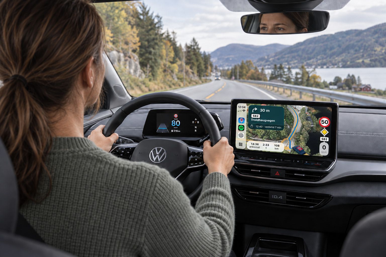
The whole trip
Made to follow you all the way
Ferries, charging, mountain passes, convoy driving and tunnels are not exceptions on a drive in Norway. They are the drive.
- The ferry
Next departure, the crossing and the queue are included in the arrival time.
- Charging
The charging stations along the route in the order you reach them, with available chargers right now.
- The mountain pass
The weather and road conditions where and when you cross, and a route around when the road is closed.
- The convoy
Convoy driving from the Norwegian Public Roads Administration on the suggested route, with the status when you pass.
- The tunnel
Every tunnel on the trip with its name and length. Guidance continues when you lose coverage.
What others treat as exceptions is normal in Norway.
Vegferd was made for what is particular here: the seasons, the mountain passes and the ferry crossings. Our focus is, and always will be, what works best for Norwegian conditions, Norwegian cars and the Norwegian road system.
Our goal is for Vegferd to be the preferred companion on any drive in Norway.
The ferry is part of the route, not a surprise
The next departure with time and quay, how long the crossing is, and how long you will queue, included in the arrival time. With Vegferd Plus: whether the departure is confirmed, delayed or cancelled, and the boat where it actually is on the map.
The price before you drive
Every toll station and ferry ticket in the order you pass them, under one total, priced for your vehicle. “Free” means free, and is never confused with the price being unknown.
Norwegian road data, not a global average
The route is calculated on our own road network, built from NVDB. Speed limit signs for the road you are on, closed roads and convoy driving from the Norwegian Public Roads Administration, and weather and road conditions on the mountain passes.
Route planning
Three suggestions, each with a reason
Choosing between two routes is as much about money as about time. Vegferd shows you what each suggestion is good for, and what it costs, before you drive, on your phone, in CarPlay and in Android Auto.
- 01 · The calculation
The route is calculated on our own road network, built from the Public Roads Administration's road database, with the clock where you are when you are there. Ferry waiting time, convoys, mountain passes closed at night, pilot cars and normal traffic for the hour are part of the search itself, so a way around can win when the wait gets long. Give the height of your vehicle, and the route avoids low underpasses.
- 02 · The suggestions
You get at most three suggestions, and each says why it is there: Fastest, Shortest, No tolls, No ferry, With ferry, Ferry not running or Around the closure. An alternative has to fit within a time budget that grows with the trip. If the route goes through a closed road, it is still shown last, marked Closed, because you might know something we do not.
- 03 · The difference
Each suggestion shows the driving time, arrival and what it costs or saves compared with the recommended one, for example “+33 min · NOK 284 saved on ferries”. On the map, a label marks where the routes part. Ferries, mountain passes, closures, tolls and ferry tickets are in the same panel, together with the elevation profile and the directions.
- 04 · The options
Leave now, choose when to leave, or say when you need to arrive. Avoid ferries, toll stations or mountain passes, and choose your vehicle, and the route and price follow. Change anything, and the route is recalculated by itself.
With Vegferd Plus you also get the suggestion that avoids one particular ferry, such as “Without Halhjem–Sandvikvåg”, and “Better weather” when an alternative avoids the bad weather. Stops along the way and charging stops are coming.
The ferry trip
From planning to dry land
A ferry trip is not a break in the navigation. Vegferd follows the whole trip, on your phone, in CarPlay and in Android Auto.
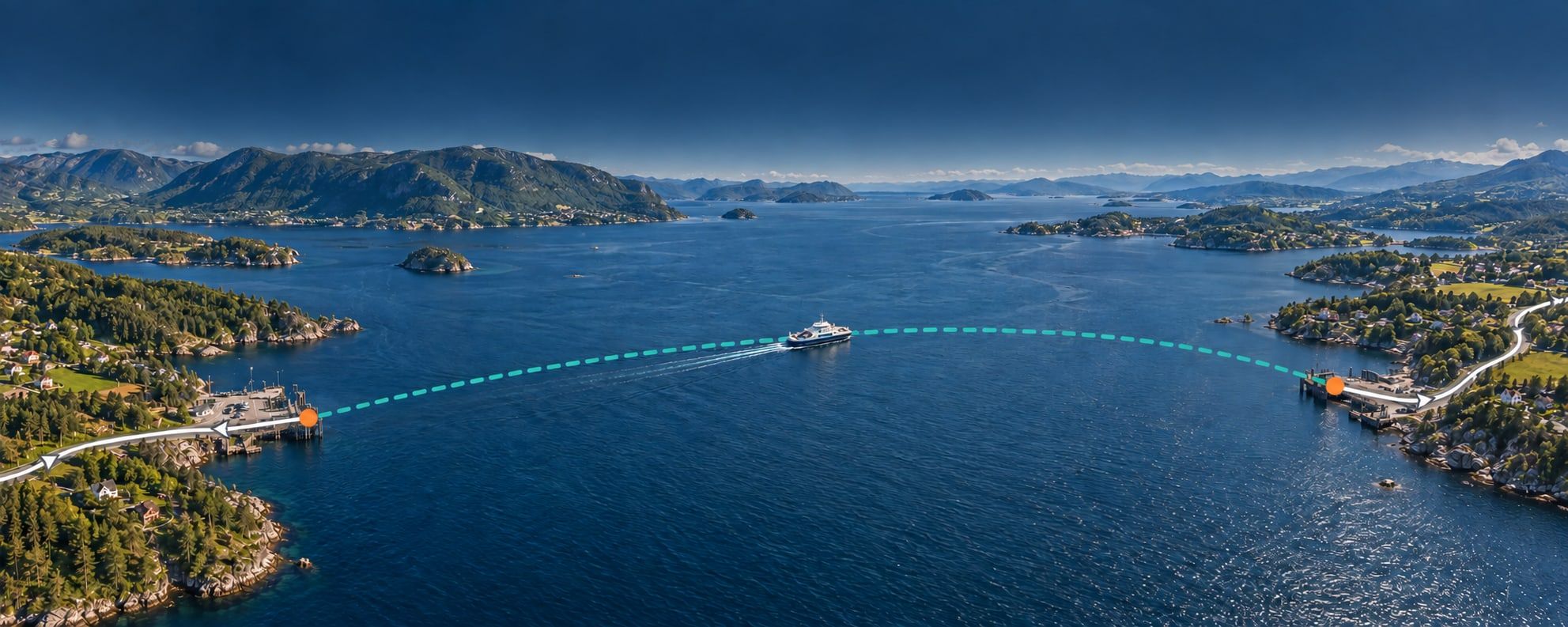
- 01 · Before you drive
The ferry is its own leg of the trip. You see the next departure you can make, from which quay, how long the crossing takes and how long you should expect to wait, and it is all included in the arrival time. The ticket is in the same total as the tolls. If the ferry is not running, or the wait gets long, you get a route around to choose instead.
- 02 · Towards the quay
A small ferry panel follows you all the way: when the boat leaves, and how long you will wait when you get there. If you will not make the departure, it shows the next one. Near the quay the full ferry card opens by itself, and on the car screen the same appears on the line below the next turn.
- 03 · On board
Vegferd knows you are at sea. The car on the map turns into the ferry, the map zooms out so you can see the fjord, and the app does not look for a new route even though the boat does not follow the line. Instead you see how long the crossing lasts, and where and when you go ashore. The sign and your speed are hidden until you are ashore, because the signs are for the road, not the sea.
- 04 · Ashore
When the ramp goes down, the car is back on the map and guidance continues where it left off. The kilometres left have not counted the sea.
With Vegferd Plus you also see whether the departure is confirmed, delayed or cancelled, and the boats where they actually are on the map.
The weather
The weather where you are, when you are there
Not the weather at the start and destination right now, but where the route goes when you drive there: mountain passes, convoys, exposed bridges and weather warnings, on your phone, in CarPlay and in Android Auto.
- 01 · The weather where you are
Vegferd looks at the weather where the route goes, at the time you are there: at the start, on every mountain pass, at the destination and along the way. Weather warnings from the Norwegian Meteorological Institute that the route passes through are shown at the top.
- 02 · The mountain pass
You see how high the road goes, and whether it is closed for the winter, has convoy driving or is closed right now, together with the Public Roads Administration's forecast road conditions for the hour you pass. Convoys and night closures are included in the route calculation, and if you get there just before the convoy leaves, Vegferd tells you.
- 03 · The bridges
On bridges where the Public Roads Administration measures, you see wind and gusts as they are measured, not as a weather model guesses them. If another suggested route has better weather in the mountains, it says so on the suggestion: “Avoids slippery road on Haukelifjell”. The choice is yours.
- 04 · Along the way
Closed roads and convoys are announced on screen and by voice before you get there, and the messages are fetched again every five minutes. The weather is shown above the elevation profile, and the weather stations can be added to the map.
Alerts about closed roads and convoys are always free. The weather, road conditions, bridges and weather stations are part of Vegferd Plus.
The traffic
Shown on the map, used in the route
Traffic is not just colours on the map. The Public Roads Administration's measurements and messages decide which road you get, when you arrive, and what you are told along the way, on your phone, in CarPlay and in Android Auto.
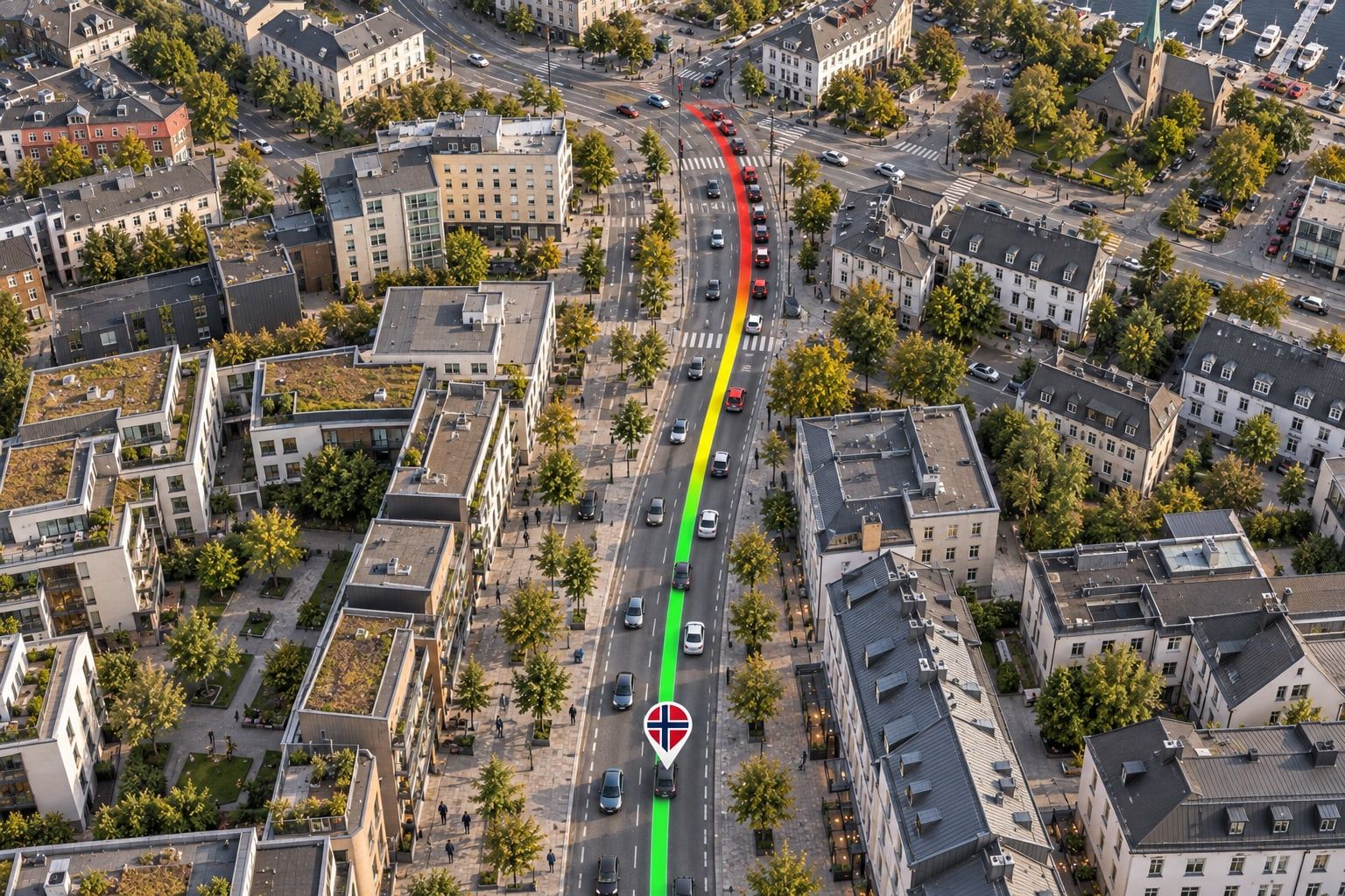
- 01 · Choosing the route
Vegferd knows what the traffic is usually like hour by hour and day by day on the stretches the Public Roads Administration measures, and chooses the route accordingly. Pilot cars and controlled passage through roadworks count as waiting time, and if the route goes through a closed road, you get a suggestion around it.
- 02 · The arrival time
On the main roads into Oslo, Bergen, Trondheim and Stavanger, the arrival time includes the queue the Public Roads Administration is measuring right now. The suggested route shows the stretches that are slower than normal, and how much queueing is included.
- 03 · The map
Turn on traffic, and the roads are coloured green, yellow and red from the Public Roads Administration's current measurements, one stripe per direction, on the main roads across the country and in the city streets of the largest cities. The route gets the same colours, and when you zoom in, the speed is shown where it is measured.
- 04 · Along the way
You are alerted on screen and by voice before a queue that takes more than one and a half times the normal time. Colours and measurements are fetched again while you drive, and the messages from the Public Roads Administration have their own page, see below.
Traffic and the messages from the Norwegian Public Roads Administration are included in Vegferd Free.
Traffic messages and alerts
What the Public Roads Administration knows, where you are driving
You only get the messages that apply to the road you are driving, and only alerts about what decides whether you get through. The rest is in a list you can read when it suits you, on your phone, in CarPlay and in Android Auto.
- 01 · The source
Everything the Norwegian Public Roads Administration reports about closed roads, roadworks, landslides, accidents and convoy driving, fetched every five minutes. Each message is attached to the road it applies to using the Administration's own road references, not an approximate location, so it hits the right road and the right direction.
- 02 · Before you drive
The suggested route shows the messages you will pass, judged against the time you will be there, not now. Closed stretches are red on every suggestion, and a route through a closed road gets a suggestion around it alongside. If you will only just make it before a convoy or night closure, it says: “Starts 00:00 — you are there 23:57”.
- 03 · The alert
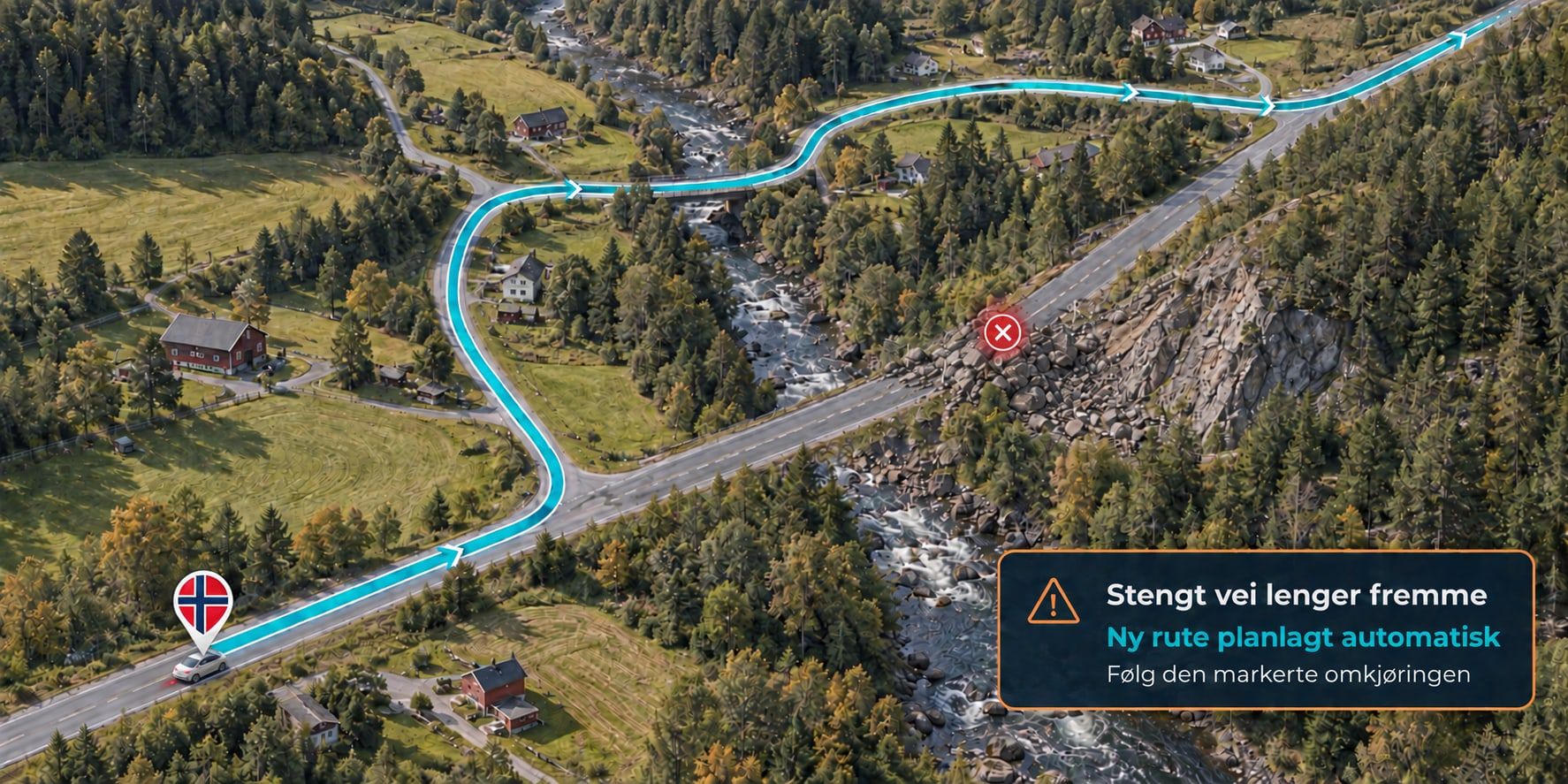
About 2 km before a closed road, a mountain pass or exposed stretch with a message, or an incident the Public Roads Administration marks as most severe, a card appears on screen, and the voice says it briefly: “In 2 kilometres: road closed at Vikafjellet”. Once per incident, and never in the middle of a turn. Roadworks and temporary speed limits do not interrupt guidance.
- 04 · The traffic list
One row per incident ahead of you, with road number, place, distance and when you pass. The status is given per vehicle group, for example “Width over 3.2 m: Road closed” and “Other vehicles: Road open”, and if the road reopens, it says when. Tap the row to see the Public Roads Administration's own text, unchanged.
Alerts about closed roads are always free. If a road ahead of you closes while you drive, Vegferd alerts you and plans a new route around it.
The sign
The signpost from the roadside, on your screen
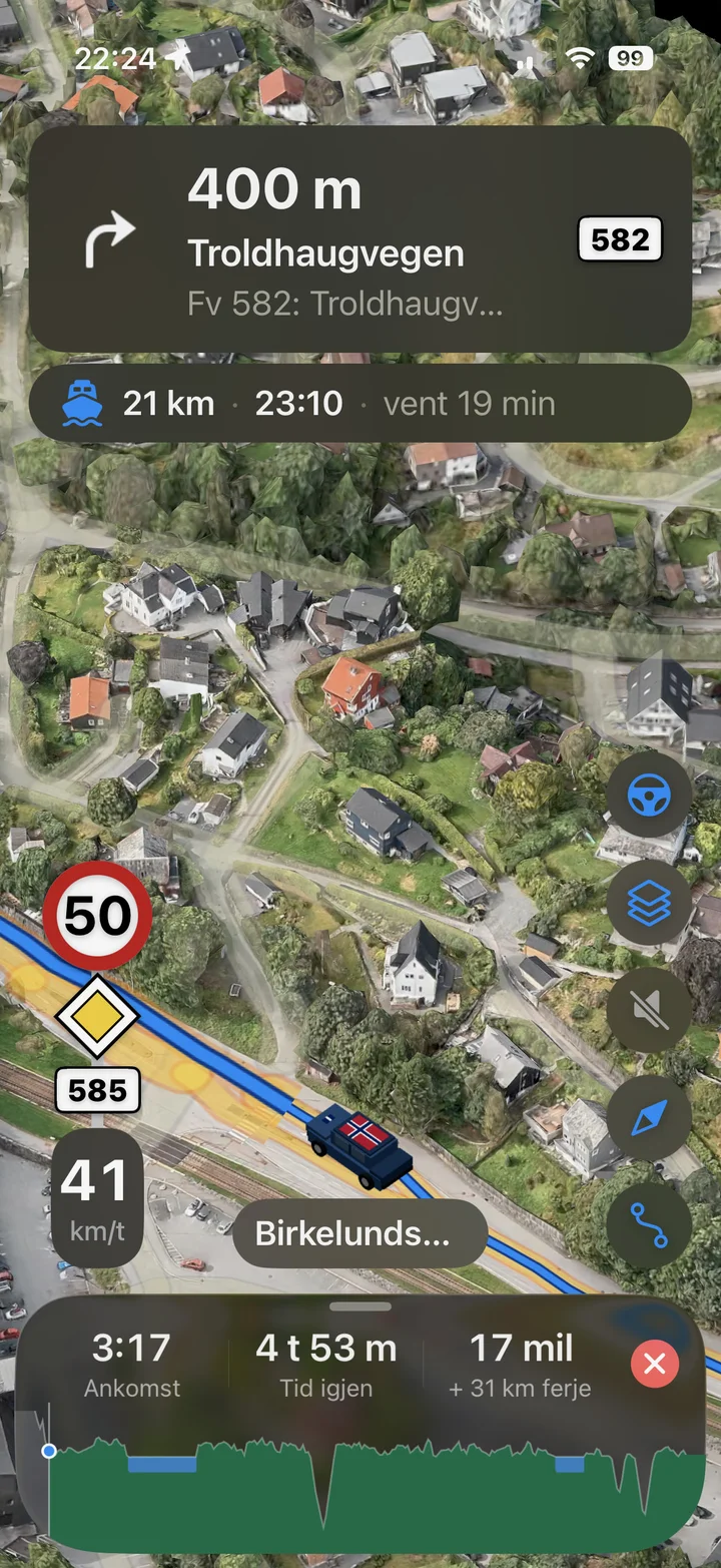
The speed limit, the priority road and the road number hang on one post, the way they stand along Norwegian roads, with your speed underneath. The same sign is on your phone, in CarPlay and in Android Auto.
- 01 · The speed limit
The round sign shows the limit where the car is now, for the direction you are driving, where the road has a different limit each way. The limits come from the Public Roads Administration's road database, and your speed is shown under the sign.
- 02 · The priority road
The yellow diamond is shown when you are on a priority road or motorway, and gets a black line when the priority road ends. If the diamond is grey, the road is not a priority road in the Public Roads Administration's database, and the rule to give way to the right applies as usual.
- 03 · The road you are on
European, national and county roads get their sign the way it looks along the road, green or white, and only where the road actually has one. On county roads and municipal roads, the street name is shown next to it. It is always the road you are on, not the one you are about to turn onto.
- 04 · When coverage drops
Vegferd has the next ten kilometres of road data in advance, so the sign stays on in tunnels too. If it does not know the limit, it shows a question mark, not the last limit it knew. On the ferry the sign and your speed disappear until you are ashore again.
The speed limit sign is always free.
Vegferd Nybrott
Become a prøvefarar
Try new features in Vegferd before everyone else, on the trips you are driving anyway, and tell us what you see. You get the app through TestFlight on iPhone and Google Play on Android.
Always free
Getting there safely is not an upgrade
Five things will never cost money, whether you have Vegferd Free, Plus or Pro.
- 01Navigation
- 02Rerouting
- 03CarPlay
- 04The speed limit sign
- 05Alerts about closed roads
Good to know
Vegferd tells you when it does not know something, instead of making it look as if it has checked: “Unknown speed limit”, “Unknown price”, “Height restrictions not checked”.
- The parking card does not say whether the space is free, or what it costs.
- [THE REST OF THE LIST IS TAKEN FROM THE USER DOCUMENTATION «GODT Å VITE» BEFORE LAUNCH]
Need help? Go to Vegferd support